Big Bunsby Marine Provincial Park
Appearance
From Wikipedia, the free encyclopedia
Provincial park in British Columbia, Canada
| Big Bunsby Marine Provincial Park | |
|---|---|
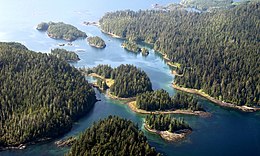
 Islands of Big Bunsby | |
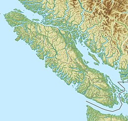
| Location | Checleset Bay, British Columbia |
| Coordinates | 50°06′09″N 127°31′50″W / 50.10250°N 127.53056°W / 50.10250; -127.53056 (Big Bunsby Marine Park) |
| Area | 658 ha (1,630 acres) |
| Designation | Marine Provincial Park |
| Established | 30 April 1996 |
| Governing body | BC Parks |
| Website | BC Parks Big Bunsby |
 | |
Big Bunsby Marine Provincial Park is a provincial park on the west coast of northern Vancouver Island in British Columbia, Canada, to the southeast of the Brooks Peninsula in Checleset Bay. It is accessible only by boat.
The park is a good spot for viewing gray whales, bald eagles and sea otters. The area of the park is 658 hectares (1,630 acres).
References
[edit]- ^ "Protected Planet | Big Bunsby Marine Park". Protected Planet. Retrieved 2020-10-04.
External links
[edit]- Big Bunsby Marine Provincial Park at BC Parks
- "Big Bunsby Marine Provincial Park". BC Geographical Names.
Hidden categories:


